Field GPS navigation –
G6 Farmnavigator
The most versatile field GPS navigation on the market
G6 Farmnavigator is a result of collaboration between AvMap – a leading Italian GPS producer – and Satconsystem, a German company specialising in modern IT farming tools. This partnership lead to creating the most comprehensive GPS device in the industry.
General features::
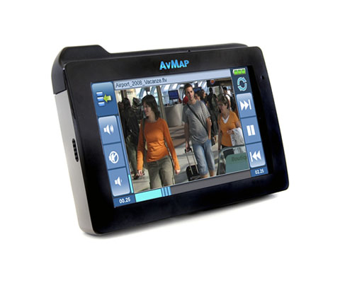
- 4.8″ touch screen display
- Internal and external waterproof GPS antenna
- Protective rubber case
- Magnetic mount for mobility
- Ffield and road navigation (Tele Atlas maps 34 of countries included)
- Report database
- Multimedia player
- External rear camera
- USB and SD slot
G6 Connect Farmnavigator features:
- Triband GSM phone
- Alcohol tester
- DVB tuner
- GeoLink Fleet compatibility
Field navigation
Choose between tracking types
Parallel Tracking
In the Parallel Tracking mode, G6 Farmnavigator creates parallel tramlines on the screen along which you can drive. Press A to start and B to end: on the display the AB segment will be traced together with its parallel segments.
Contour Tracking
In the Contour Tracking mode, you can create the first tramline in a curved field, by pressing A to start and B to end, then this tramline will be replicated over the whole field.
Existing Tramlines Tracking
In fields with existing tramlines or planted with row crops, you can switch the Farmnavigator to the Tramline mode. In this mode there is no navigation bar, but you can see the real time green track and it can be used to work with the virtual sprayboom switch.
Other functions and advantages:
Virtual spray boom commander
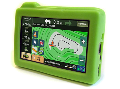
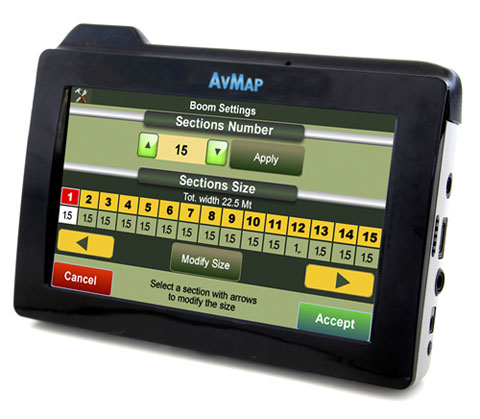
G6 Farmnavigator shows the area that has already been treated and thanks to the virtual spray boom commander it helps you saving chemical products, reducing costs and improving productivity. You can customize the spraying bar setting the number of sections (up to 15), their length and the number of booms for each section. During the navigation the virtual spray boom control will show which spray boom section has to be switched off to avoid overlapping. These warnings are very useful when making a U turn or when trying to avoid an obstacle.
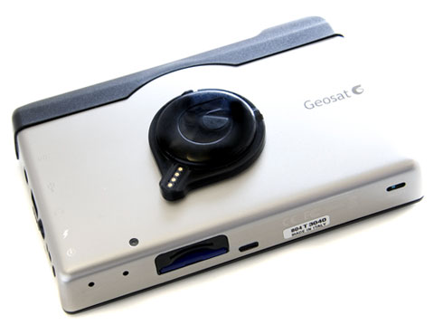
Special magnetic dock
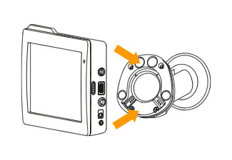 G6 Farmnavigator works on every field and can be used in different vehicles; it is very practical to remove it as it is 100% portable. The smart magnetic mount makes it easy to plug it, with no need for cables as the dock station is powered. Extra mounts can be purchased as spare parts.
Save your fields and view them on Google Earth™
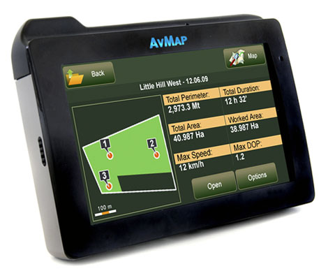
When you start a new work on the field, all its data (perimeter, area, treated area, obstacles, timing, maximum DOP and maximum speed) will be saved in the database. The work can be paused and restarted at any moment. You can see a data sheet for each field and you can export the database to Google Earth and print it.
Rear view camera
The G6 Farmnavigator can be connected to an USB Rear View Camera. If you need to check the functioning of the machine or to view behind a trailor just click the Camera button on the touch screen and the live video will appear on the display.
More fetails:
A detailed description of all functions can be found in the instruction manual (PDF).
Use the app below to check out the G6 Farmnavigator user interface:
Video:
click to play:
Photos:
click to zoom: