Soil sampling & analysis —
taking samples, lab analysis, nutrient mapping
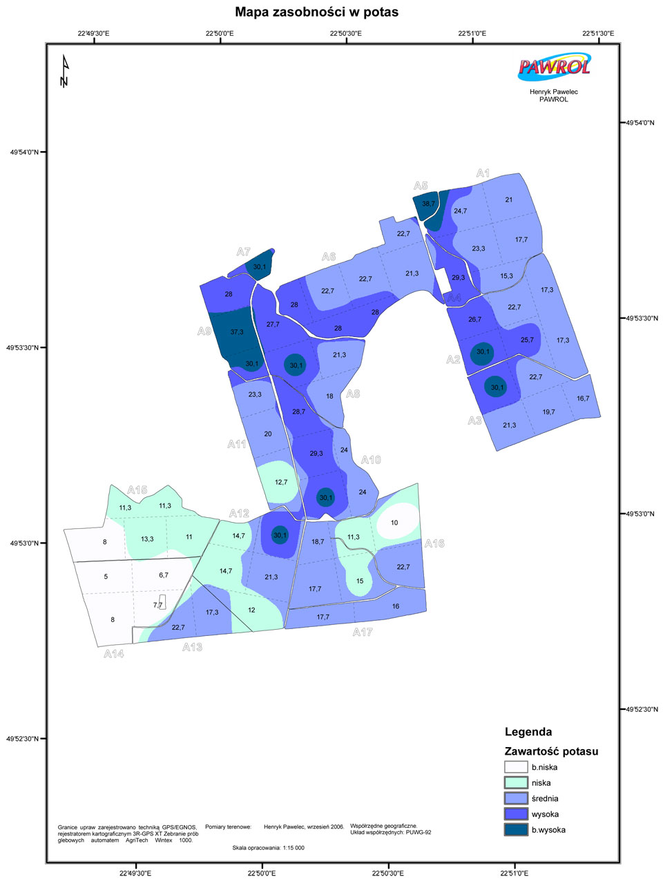
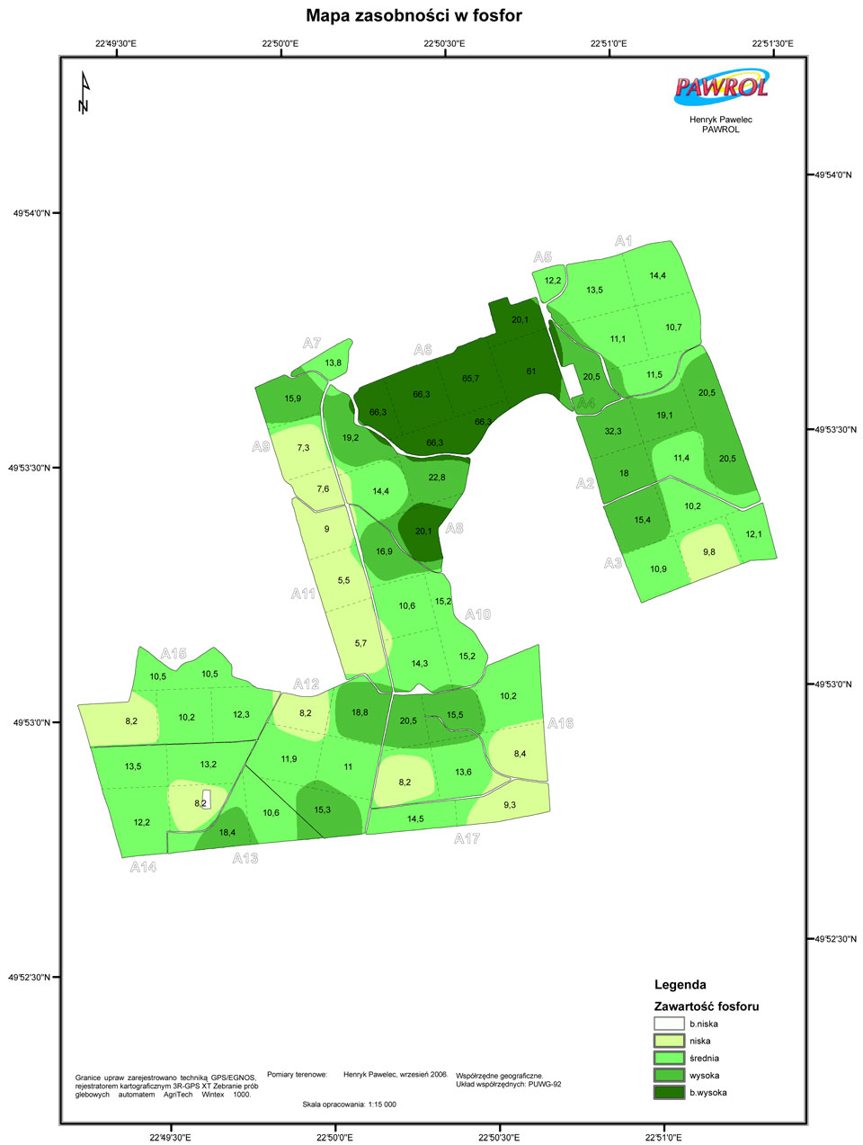
Regular soil tests are not only a requirement of good agricultural practice but are also advised by certain regulations. However, precision farming requires something more – namely checking the distribution of nutrients across your fields. This variability will then be the basis for variable rate application. Provided the differences between the level of nutrients are high, this method will generate a considerable reduction of expenses spent on fertilizers.
Skilful use of GPS navigation and accurate soil sampling are the key to creating precise nutrient and variety maps.
How we do it?
Precise soil sampling consists of the following steps:
1. Measuring the area for analysis
This first step is crucial since it allows to establish the number of samples to take. The process is performed with the same GPS-based set as in field measuring for IACS. The map created can as well be used for the latter.
2. Choosing the area for sampling
Mensuration software allows us to select sectors to draw particular samples. A sample is normally drawn from an area not larger than 4 hectares, however, it can also be drawn from smaller sectors (1, 2 or 3 hectares). Higher density of sectors allows a more accurate projection of nutrients on a field.
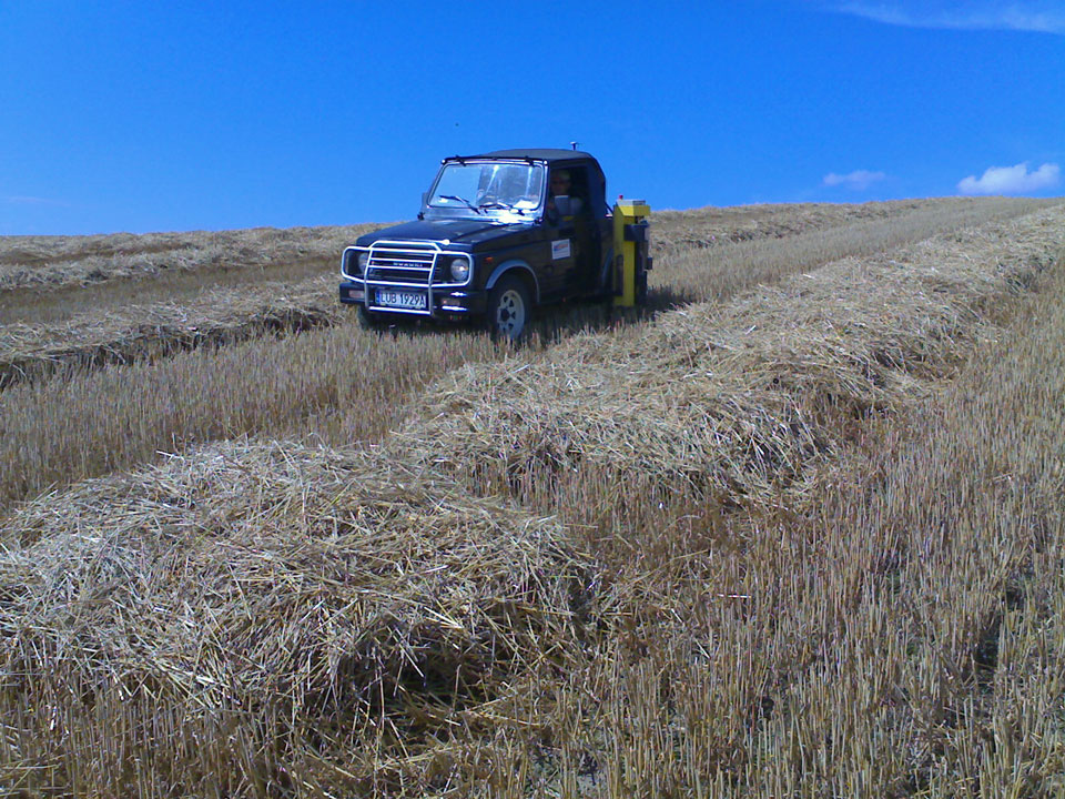
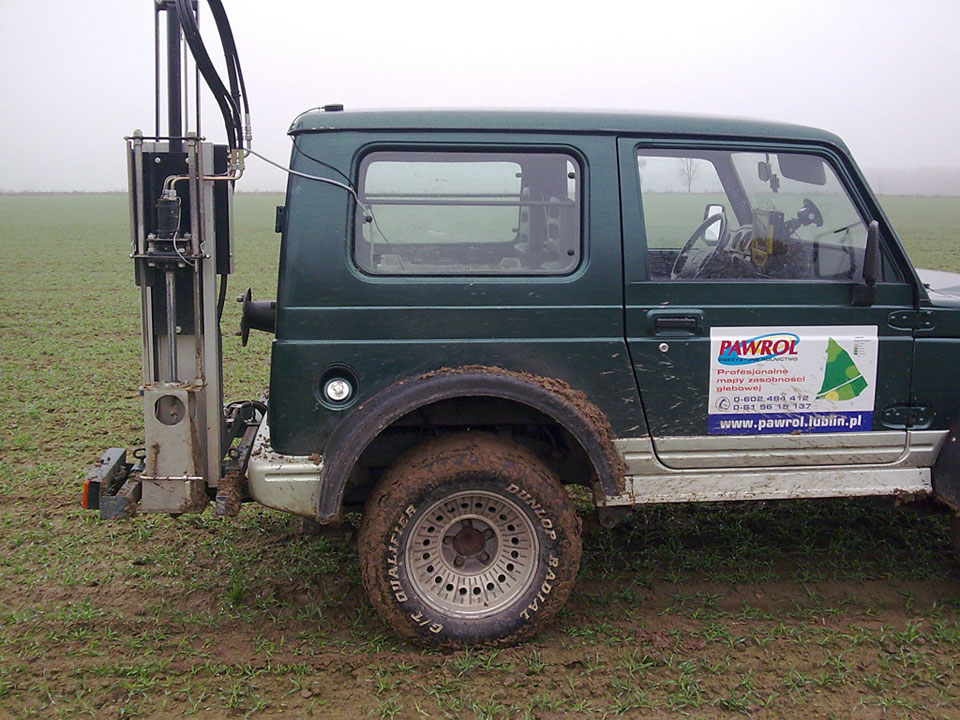
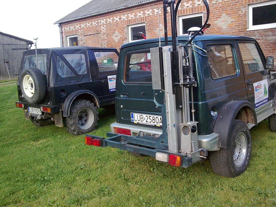
3. Collecting soil for analysis
This step is performed with a GPS set and a hydraulic probe installed on a quad bike or a light SUV. One attempt usually consists of 12 to 24 pushes of the probe. Soil sampled is placed in a special box. Each push is monitored via GPS signal in the field computer. After collecting enough soil, the box is tagged with a unique ID, which is crucial when generating nutrient maps, precise fertilization plans and application maps.
4. Laboratory analysis
Collected and tagged, soil samples are tested in a laboratory. Analysis can establish the amount of:
- H + microelements (phosphor, potassium and magnesium)
- boron + microelements (zinc, manganese, copper and iron)
- sulfur, humus (calcium)
- heavy metals
Analysis results are delivered in digital form.
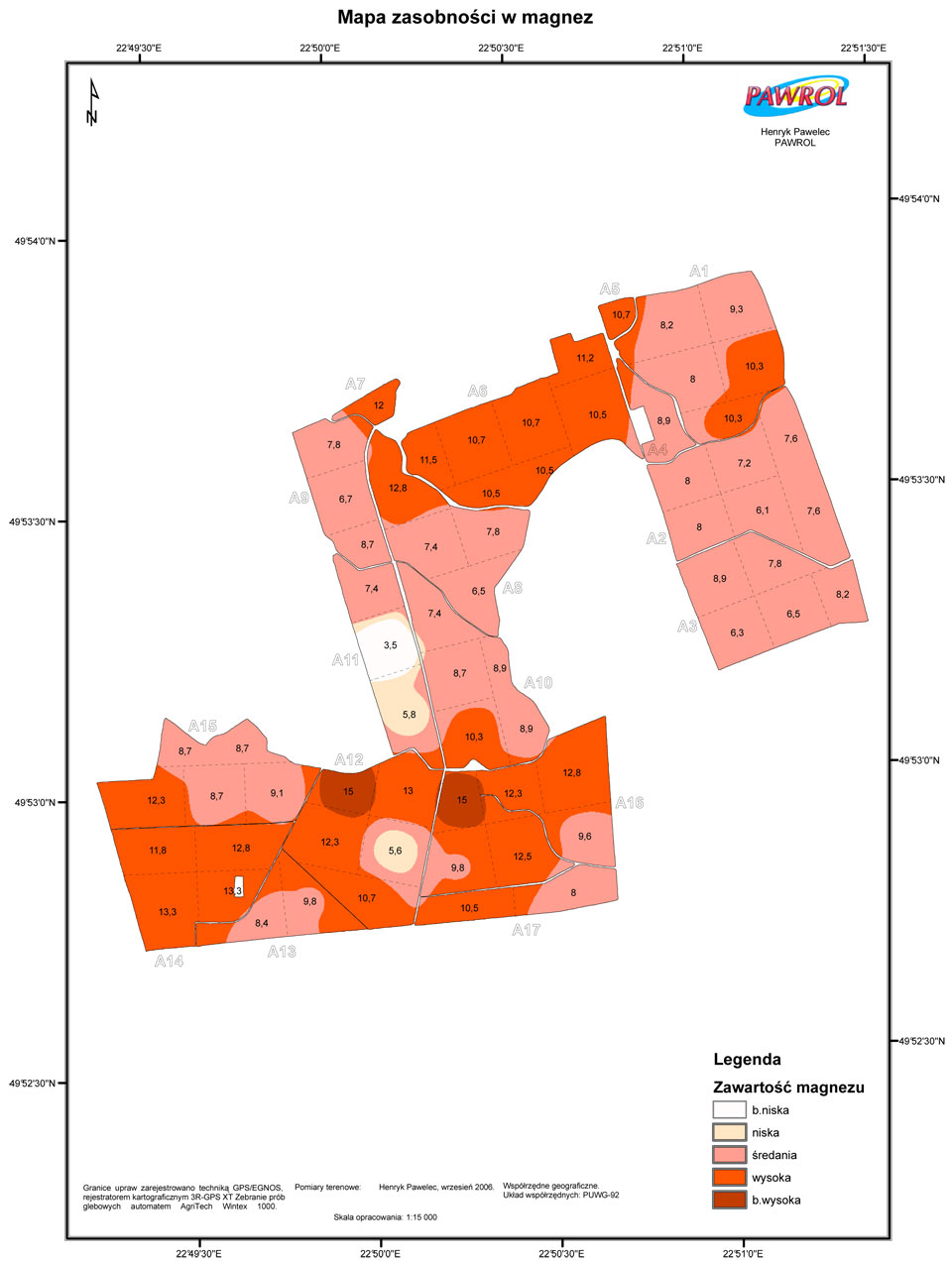
5. Nutrient mapping
Data gathered is used to create maps showing the amount of particular nutrients across your fields. Each map is compatible with widely-used software, such as SMS by Ag Leader.


 site index